

 I like it...
|
The Sites |
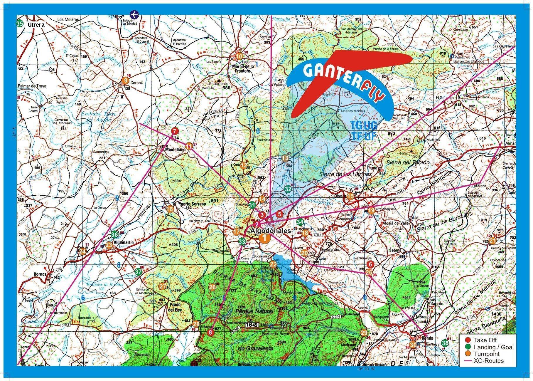
| Flying Map, coordinates of take offs, turnpoints and landings and site map of the Sierra de Lijar with mountain roads, take offs and landings |
|---|
| The sites themselves have played
host to the 2001 World Air Games, that says enough about their potential.
They however accommodate pilots of every level and many British schools
use them as their home from home. All wind directions are covered and as
yet it's a hardly discovered flyers paradise! Below are some descriptions
of the sites, they are very brief and you should ask before you even rig
better still use a guide. Sierra de Lijar:- 4 take offs all accessed the same way. From La Muela go with the hill to your right, about a mile on your right is a signposted track PISTE follow it to the launches. There are separate launches for the following wind directions: SE, E, SW and NW. The NW-takeoff has been improved recently. Montellano: N-NE. Very good when sunny to find it you will probably need help but very worth the effort. At a park on the north side of the town and the take off is through the park, landing is by the side of the road below. Thanks for the lower takeoff we can also use it in strong wind conditions. Ronda La Vieja:- West ridge about 7 K past El Gastor next to Setenil well worth the effort, will take W-N. With stronger winds we use the lower takeoff and with normal or weak winds we launch from the upper takeoff. El Bosque:- West ridge about 25k to the south. A good place when we have strong winds, because there it's always much weaker. Conil de la Frontera:- Sea cliffs, just south of Cadiz. Gallery with lots of site & flying pictures, all taken on these sites. |